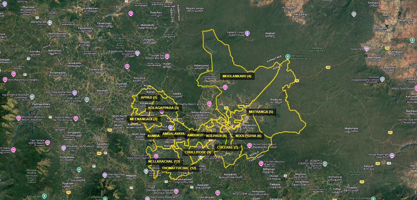
Geography and Map
The Sulthanbathery Block Panchayat, headquartered at Sulthanbathery, is situated in the south-eastern region of Wayanad district. Forming part of the Western Ghats, the region is distinguished by its rich natural resources, diverse geographical features, and favourable climatic conditions.
The geographical area of the Block Panchayat primarily consists of mountain ranges, small hills, valleys, agricultural lands, and forest areas. Located at an elevation of approximately 700 to 1,200 metres above sea level, the region experiences a moderate and pleasant climate. The abundant rainfall received from both the Southwest and Northeast Monsoons provides strong support to the agricultural sector.
The region is rich in water resources, comprising numerous streams, small rivers, and water reservoirs. Being part of the Kabini River basin, the area holds significant importance in terms of its natural water resources. The extensive forest cover and rich biodiversity further enhance the ecological significance of the region.
Agriculture is the primary livelihood of the people in the area. Crops such as paddy, coffee, pepper, ginger, cardamom, and banana are widely cultivated. The combination of natural beauty, agricultural traditions, and forest resources defines the distinctive geographical characteristics of Sulthanbathery Block Panchayat.